|
Price
|
€ 25 |
|
Day & Time
|
Thursdays starting at 10:00 (walking calendar) |
|
Meeting Point
|
Nerja bus station, Nerja (map) at 09:30, and then at the Frigiliana bus stop, Frigiliana (map) at 10:00. |
|
Minimum Group size
|
Limited number of spaces available on each walk in order to maintain group safety and good walker/guide ratio. |
|
Start Time
|
10:00 at the main Frigiliana bus stop, Frigiliana (map) |
|
Finish Time
|
16:00 at Nerja Caves |
|
Walking Time
|
6 hours (includes stops for breaks, lunch, photos, etc.) |
|
Walking Distance
|
14 kilometres (linear route) |
|
Height Gained
|
800 metres (from Frigiliana) |
|
Level of Difficulty
|
3A (rating explanation) |
|
Risk of vertigo
|
No |
|
Recommendations
|
Hiking boots or walking shoes with thick socks are highly recommended. Trainers/tennis shoes not ideal but will suffice. Definitely no flip-flops, sandals, beach wear or similar, please. A good level of fitness is also required. Bring something to eat for lunch, sufficient water and appropriate clothing. |
|
Additional Gear
|
Walking poles will be useful for numerous sections of ascent and descent during the first leg. |
|
Highlights
|
Impressive views, extensive pine forests, natural mountain spring, chance of wildlife spotting, walk through mini gorge. |
|
Facilities
|
Lavatory, drinks and food available at Nerja Caves. |
|
Observations
|
This walk starts in Frigiliana at 10:00 at the main Frigiliana bus stop in the centre of the village (map). Walkers based in Nerja should meet me no later than 09:30 at the Nerja town meeting point (map). We will catch the 09:45 bus for Frigiliana and meet the Frigiliana group at the Frigiliana meeting point at approximately 10:00, when this walk will begin. This walk ends at the Nerja Caves at approximately 16:00. Walkers based in Frigiliana will be able to catch either the 16:15 or 17:00 bus to Nerja, and then catch the 19:00 bus to get back to Frigiliana. |
|
Map of walking area
|
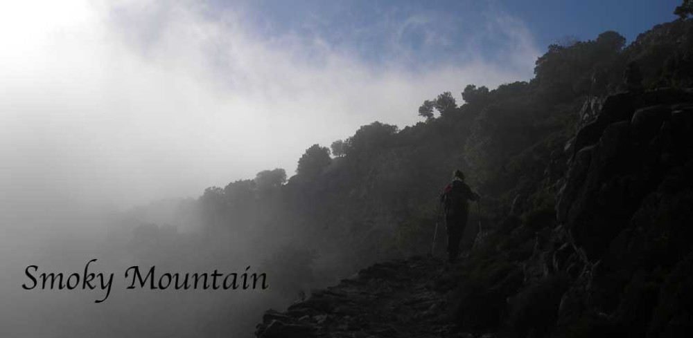
This is a nice hike with some moderately challenging sections in the first leg, and an easy stroll downhill all of the way to our finishing point in the second leg. The hike begins in Frigiliana with a quick descent into the Río Higuerón valley. We follow the river upstream for a while before turning onto a path which takes up through the pines and undergrowth and up the valley sides to emerge onto a spur with views into the adjacent valley.
After a brief pause to catch our breaths, we catch another path that leads us along a pretty mountainside on level terrain dominated by Mediterranean scrub, and with lovely views of the Chillar river valley below. Now the unmistakable bellow of the Chillar river in the distance comes into earshot. Its sound is very exciting and captivating. After some more lovely walking along the mountainside, dipping and rising occasionally along the path through a modest patch of mixed forest, and a short section of steepish ascent to get over a modest spur, we descend to the Chillar river below. The river is a good spot for a break and to recharge our walking batteries.
After our lunch break, we leave the river and follow a path through the river undergrowth on the other bank, and begin a relatively easy climb up the other side of the Chillar valley, continuing up the hillside until we get to a mountain pass with nice views of the surrounding mountainside. This is a good place for another rest and to take in the lovely views, perhaps also an opportunity for photography enthusiasts to partake in some immortalising.
From this point on, the walk is very easy as we follow well-maintained forest trails on a gentle descent. On the way we will come across a natural spring where we can stop for a refreshing drink before continuing down our route. The last leg of our hike gives us the option of either taking a path through a lovely, wide and long dry river gorge lined with eucalyptus trees, or just following the main track all the way back to Maro.
Click here to enquire or book this walk!
